Difference between revisions of "SYMMES & ASSOCIATES"
| (23 intermediate revisions by the same user not shown) | |||
| Line 4: | Line 4: | ||
<center><gallery widths=400px heights= | <center><gallery widths=400px heights=500px mode=nolines perrow=2 caption="Symmes and Associates, Santa Cruz Island, 1922 "> | ||
Image: S&A 1922 pg 9a.jpg|<center> The central or main valley (Cañada del Medio) east from Portezuela. Eucalyptus trees at the Main Ranch in the center distance. Christy road grade in foreground.<br>Santa Cruz Island, Symmes, 1922</center> | Image: S&A 1922 pg 9a.jpg|<center> The central or main valley (Cañada del Medio) east from Portezuela. Eucalyptus trees at the Main Ranch in the center distance. Christy road grade in foreground.<br>Santa Cruz Island, Symmes, 1922</center> | ||
| Line 24: | Line 24: | ||
Image: S&A 1922 pg 11b.jpg|<center>Cañada del Puerto at point half way between Main Ranch and Prisoners' Harbor where it commences to widen out, showing dry wash, surface flow, oaks and nature of the hills. <br> Santa Cruz Island, Symmes, 1922</center> | Image: S&A 1922 pg 11b.jpg|<center>Cañada del Puerto at point half way between Main Ranch and Prisoners' Harbor where it commences to widen out, showing dry wash, surface flow, oaks and nature of the hills. <br> Santa Cruz Island, Symmes, 1922</center> | ||
Image: S&A 1922 pg 19a.jpg|<center>North side of Main Ridge west of Montañon, the narrowest part of the island. <br>Santa Cruz Island, Symmes, 1922</center> | Image: S&A 1922 pg 19a.jpg|<center>North side of Main Ridge west of Montañon, <br>the narrowest part of the island. <br>Santa Cruz Island, Symmes, 1922</center> | ||
Image: S&A 1922 pg 19b.jpg|<center>Cattle on the flats at Campo Chino in Portero Norte. <br> Santa Cruz Island, Symmes, 1922</center> | Image: S&A 1922 pg 19b.jpg|<center>Cattle on the flats at Campo Chino in Portero Norte. <br> Santa Cruz Island, Symmes, 1922</center> | ||
| Line 30: | Line 30: | ||
Image: S&A 1922 pg 19c.jpg|<center>View looking northeast from Main Ridge east of Portrero Norte, showing Pinos de Mielquieres and Campo Chino, and Montañon in distance. <br> Santa Cruz Island, Symmes, 1922</center> | Image: S&A 1922 pg 19c.jpg|<center>View looking northeast from Main Ridge east of Portrero Norte, showing Pinos de Mielquieres and Campo Chino, and Montañon in distance. <br> Santa Cruz Island, Symmes, 1922</center> | ||
Image: S&A 1922 pg. 28a.jpg|<center>Quebradas from the top of the Montañon looking East. Showing the table land or mesa character of the east end of the island and brush covered eastern slope of the Montañon. Anacapa Island is shown in the distance. <br> Santa Cruz Island, Symmes, 1922</center> | Image: S&A 1922 pg. 28a.jpg|<center>Quebradas from the top of the Montañon looking East. Showing the table land or mesa character of the east end of the island and brush covered eastern slope of the Montañon.<br> Anacapa Island is shown in the distance. <br> Santa Cruz Island, Symmes, 1922</center> | ||
Image: S&A 1922 pg. 28b.jpg|<center> Characteristic mesas above. Scorpion Canyon showing wagon road to Campo Los Toros and Grande, limestone character of the soil and feed conditions where sheep range freely.<br> Santa Cruz Island, Symmes, 1922</center> | Image: S&A 1922 pg. 28b.jpg|<center> Characteristic mesas above. Scorpion Canyon showing wagon road to Campo Los Toros and Grande, limestone character of the soil and feed conditions where sheep range freely.<br> Santa Cruz Island, Symmes, 1922</center> | ||
| Line 47: | Line 47: | ||
Image: S&A 1922 pg 33c.jpg|<center> Ermitaño alfalfa field on fertile bottom land Cañada la Cuesta, typical growth of cactus on northern slope of canyon and brush on southern. Feed conditions typical of west end of island. Shetland stallion at right.<br> Santa Cruz Island, Symmes, 1922</center> | Image: S&A 1922 pg 33c.jpg|<center> Ermitaño alfalfa field on fertile bottom land Cañada la Cuesta, typical growth of cactus on northern slope of canyon and brush on southern. Feed conditions typical of west end of island. Shetland stallion at right.<br> Santa Cruz Island, Symmes, 1922</center> | ||
Image: S&A 1922 pg. 41a.jpg|<center> Aguaje showing growth of feed on areas partly protected from sheep. Anacapa Island in the distance.<br> Santa Cruz Island, Symmes, 1922</center> | |||
Image: S&A 1922 pg. 41b.jpg|<center>Orizaba Flats looking east. Feed conditions typical of areas on which sheep range freely. <br> Santa Cruz Island, Symmes, 1922</center> | |||
Image: S&A 1922 pg. 50a.jpg|<center> Owner's residence at the Main Ranch. Ranch kitchen and office building in the background.<br> Santa Cruz Island, Symmes, 1922</center> | |||
Image: S&A 922 pg. 50b.jpg|<center>Main Ranch buildings, Superintendent's residence, owner's residence at left, and ranch office and kitchen buildings in background at right. <br> Santa Cruz Island, Symmes, 1922</center> | |||
Image: S&A 1922 pg. 51a.jpg|<center>Main Ranch showing winery, alfalfa shocked in Campo Dos Pinos, part of vineyard in Church District, owners residence, eucalyptus windbreak and typical area of brush covered northern slope of southern ridge. <br> Santa Cruz Island, Symmes, 1922</center> | |||
Image: S&A 1922 pg. 51b.jpg|<center> Main Ranch looking northwest, characteristic brush and cactus growth on Main Diablo ridge, Mission vineyard on hillside at the left, eucalyptus trees bordering approach from Prisoners harbor on right.<br> Santa Cruz Island, Symmes, 1922</center> | |||
Image: S&A 1922 pg. 61a.jpg|<center>Steers in the Potrero Mediano, showing excellent feed conditions on range from which sheep are excluded. <br> Santa Cruz Island, Symmes, 1922</center> | |||
Image: S&A 1922 pg. 61b.jpg|<center>Long wooled coludo on flats east of Forneys. <br>Feed typical of areas on which sheep range freely.<br> Santa Cruz Island, Symmes, 1922</center> | |||
Image: S&A 1922 pg. 66a.jpg|<center>East of cellar at Main Ranch. Rough plowed vineyard at right, road leading to the east, walnut trees and Campo Dos Pinos in the foreground, with creek in middle distance, and Church and Mondo Novo [New World] vineyards in the distance.<br> Santa Cruz Island, Symmes, 1922</center> | |||
Image: S&A 1922 pg. 66b.jpg|<center>Rough plowed vineyard east of cellar, road to the east, and eucalyptus trees at the Selva.<br> Santa Cruz Island, Symmes, 1922</center> | |||
Image: S&A 1922 pg. 66c.jpg|<center>Burgundy vineyard on lower slopes with typical growth of brush and cactus on hills in the rear. Dry wash of Main creek in foreground.<br> Santa Cruz Island, Symmes, 1922</center> | |||
Image: S&A 1922 pg. 69a.jpg|<center>Part of Church District vineyard, hay in Campo Dos Pinos, winery at left, church at right, ranch in middle background with chaparral covered secondary ridge in back.<br> Santa Cruz Island, Symmes, 1922</center> | |||
Image: S&A 1922 pg. 69b.jpg|<center>Fields west of ranch, Upper at right,<br> Domestic at left and part of General in foreground.<br> Santa Cruz Island, Symmes, 1922</center> | |||
Image: S&A 1922 pg. 69c.jpg|<center>The European field.<br> Santa Cruz Island, Symmes, 1922</center> | |||
Image: S&A 1922 pg. 80a.jpg|<center>Main creek at Cascada showing flow of water sufficient to supply Main Ranch and irrigate considerable land in addition.<br> Santa Cruz Island, Symmes, 1922</center> | |||
Image: S&A 1922 pg. 80b.jpg|<center>Main creek just below ranch showing surface flow sufficient to irrigate all level land in Main Valley.<br> Santa Cruz Island, Symmes, 1922</center> | |||
Image: S&A 1922 pg. 83a.jpg|<center>Area of Monterey pine in upper reaches of Cañada la Cuesta. <br>Largest area and best stand found on the island.<br> Santa Cruz Island, Symmes, 1922</center> | |||
Image: S&A 1922 pg. 83b.jpg|<center>North shore of Island above Pelican Bay showing area of <br>Monterey pine known as Pinos Chicos.<br> Barren area at right due to fire in 1918.<br> Santa Cruz Island, Symmes, 1922</center> | |||
Image: S&A 1922 pg. 83c.jpg|<center>Sur side range east of Sur Ranch, badly cut up by barrancas and canyons showing typical limestone formation.<br> Santa Cruz Island, Symmes, 1922</center> | |||
Image: S&A 1922 Glossary pg 1a.jpg|<center>Prisoners Harbor showing wharf, mouth of creek, beach, brick warehouses, adobe house, lagunita, small cultivated field and eucalyptus trees. Growth on hills to the right very typical of large area of north coast from Prisoners west.<br> Santa Cruz Island, Symmes, 1922</center> | |||
Image: S&A Glossary pg. 1b.jpg|<center>Smugglers Cove with heavy growth of feed on lime adobe hillsides where sheep have not fed to any extent. Adobe house, fig, walnut, eucalyptus and olive trees shown. Cuts in the hillside show limestone formation plainly. <br> Santa Cruz Island, Symmes, 1922</center> | |||
Image: MISSING |<center>Pelican Bay with cottages on spit running out to form the bay, Diablo ridge in the distance, growth on hills principally Monterey pine, oak and manzanita.<br> Santa Cruz Island, Symmes, 1922</center> | |||
Image: |<center><br> Santa Cruz Island, Symmes, 1922</center> | |||
Image: |<center><br> Santa Cruz Island, Symmes, 1922</center> | |||
Image: |<center><br> Santa Cruz Island, Symmes, 1922</center> | |||
Image: |<center><br> Santa Cruz Island, Symmes, 1922</center> | |||
Image: |<center><br> Santa Cruz Island, Symmes, 1922</center> | |||
Image: |<center><br> Santa Cruz Island, Symmes, 1922</center> | |||
Image: |<center><br> Santa Cruz Island, Symmes, 1922</center> | |||
Image: |<center><br> Santa Cruz Island, Symmes, 1922</center> | |||
Image: |<center><br> Santa Cruz Island, Symmes, 1922</center> | |||
Image: |<center><br> Santa Cruz Island, Symmes, 1922</center> | |||
Image: |<center><br> Santa Cruz Island, Symmes, 1922</center> | |||
Image: |<center><br> Santa Cruz Island, Symmes, 1922</center> | |||
Image: |<center><br> Santa Cruz Island, Symmes, 1922</center> | |||
Image: |<center><br> Santa Cruz Island, Symmes, 1922</center> | |||
Image: |<center><br> Santa Cruz Island, Symmes, 1922</center> | |||
Image: |<center><br> Santa Cruz Island, Symmes, 1922</center> | |||
Image: |<center><br> Santa Cruz Island, Symmes, 1922</center> | |||
Image: |<center><br> Santa Cruz Island, Symmes, 1922</center> | |||
Image: |<center><br> Santa Cruz Island, Symmes, 1922</center> | |||
Image: |<center><br> Santa Cruz Island, Symmes, 1922</center> | |||
Image: S&A 1922 report Glossary pg. 10a.jpg|<center>Potato Harbor showing seal cave and cliffs.<br> Santa Cruz Island, Symmes, 1922</center> | |||
Image: S&A 1922 report Glossary pg. 10b.jpg|<center>Flats east of Forneys showing caves in volcanic rock, <br>formerly inhabited by Indians.<br> Santa Cruz Island, Symmes, 1922</center> | |||
Image: S&A 1922 report Glossary pg. 11a.jpg|<center>East entrance and beach Cueva Valdez. <br>North entrance shown as line on face of cliff at right.<br> Santa Cruz Island, Symmes, 1922</center> | |||
Image: S&A 1922 report Glossary pg. 11b.jpg|<center>View through North entrance Cueva Valdez looking <br>across harbor showing cliffs and rock formation.<br> Santa Cruz Island, Symmes, 1922</center> | |||
Image: Image gallery placeholder.jpg | Image: Image gallery placeholder.jpg | ||
Latest revision as of 04:45, 25 November 2015
Symmes and Associates, a San Francisco based agricultural engineering firm owned by Leslie Webb Symmes (1879-1956), was hired in the spring of 1922 to complete an assessment of Santa Cruz Island to accompany the island partition action ordered by the court. Their 93 page report was based on field investigations made during the months of March and April, 1922 along with a study of available data of past island conditions and operations of the Santa Cruz Island Company. Their report paid particular interest in range conditions for feed and water since the island’s primarily use was as livestock property. The Symmes report identified Prisoners’, Chinese and Smugglers as the most important harbors. This unpublished manuscript is on file at the Santa Cruz Island Foundation.
- Symmes and Associates, Santa Cruz Island, 1922

The central or main valley (Cañada del Medio) east from Portezuela. Eucalyptus trees at the Main Ranch in the center distance. Christy road grade in foreground.
Santa Cruz Island, Symmes, 1922
View of Cañada del Indio from southern ridge showing vineyard areas on lower slopes. Diablo ridge in distance.
Santa Cruz Island, Symmes, 1922
Beach at Smugglers Cove protected from Northwest winds by San Pedro Point. Olive grove and eucalyptus trees shown. Excellent feed in foreground due to absence of sheep. White marks show limestone nature of this territory.
Santa Cruz Island, Symmes, 1922
Wharf and beach at Prisoners Harbor.
Santa Cruz Island, Symmes, 1922
Pelican Bay resort showing spit running out into water and wooded hills. Trees principally oak and Monterey pine.
Santa Cruz Island, Symmes, 1922
China Harbor looking east from Potrero Norte.
Santa Cruz Island, Symmes, 1922
China and Prisoners Harbors looking west from the main ridge above Campo Chino.
Santa Cruz Island, Symmes, 1922
Narrow point of Cañada del Puerto a short distance below Main Ranch showing surface water flow, oak trees and steep hillsides.
Santa Cruz Island, Symmes, 1922
Cañada del Puerto at point half way between Main Ranch and Prisoners' Harbor where it commences to widen out, showing dry wash, surface flow, oaks and nature of the hills.
Santa Cruz Island, Symmes, 1922
North side of Main Ridge west of Montañon,
the narrowest part of the island.
Santa Cruz Island, Symmes, 1922
Cattle on the flats at Campo Chino in Portero Norte.
Santa Cruz Island, Symmes, 1922
View looking northeast from Main Ridge east of Portrero Norte, showing Pinos de Mielquieres and Campo Chino, and Montañon in distance.
Santa Cruz Island, Symmes, 1922
Quebradas from the top of the Montañon looking East. Showing the table land or mesa character of the east end of the island and brush covered eastern slope of the Montañon.
Anacapa Island is shown in the distance.
Santa Cruz Island, Symmes, 1922
Characteristic mesas above. Scorpion Canyon showing wagon road to Campo Los Toros and Grande, limestone character of the soil and feed conditions where sheep range freely.
Santa Cruz Island, Symmes, 1922
Mesas to the east of Aguaje with deep canyons and barrancas between cut through limestone formation of this territory.
Santa Cruz Island, Symmes, 1922
Blue Banks Potrero looking south showing steep character of the territory and signs of limestone formation in the washes.
Santa Cruz Island, Symmes, 1922
Cañada Coches Prietos looking west with Los Tores in the center and the Colorados in the distance, the harbor and creek bed filled with willows at the left and the long cuchillos running down from the ridge at the right.
Santa Cruz Island, Symmes, 1922
Los Colorados looking south from the secondary or southern ridge, with Sierra Blanca shown in the distance. The ridges are the characteristic long, chaparral covered, cuchillos running to the ocean from the southern ridge.
Santa Cruz Island, Symmes, 1922
Upper reaches of Cañada Los Sauces showing erosion of fertile bottom lands, washing of hillsides, and a scattered stand of Monterey Pines at the right.
Santa Cruz Island, Symmes, 1922
Cañada la Cuesta looking east. Typical dry wash in bottom of canyon, brush covered southern slope of canyon at right and open northern slope on which sheep can be seen grazing.
Santa Cruz Island, Symmes, 1922
Ermitaño alfalfa field on fertile bottom land Cañada la Cuesta, typical growth of cactus on northern slope of canyon and brush on southern. Feed conditions typical of west end of island. Shetland stallion at right.
Santa Cruz Island, Symmes, 1922
Aguaje showing growth of feed on areas partly protected from sheep. Anacapa Island in the distance.
Santa Cruz Island, Symmes, 1922
Orizaba Flats looking east. Feed conditions typical of areas on which sheep range freely.
Santa Cruz Island, Symmes, 1922
Owner's residence at the Main Ranch. Ranch kitchen and office building in the background.
Santa Cruz Island, Symmes, 1922
Main Ranch buildings, Superintendent's residence, owner's residence at left, and ranch office and kitchen buildings in background at right.
Santa Cruz Island, Symmes, 1922
Main Ranch showing winery, alfalfa shocked in Campo Dos Pinos, part of vineyard in Church District, owners residence, eucalyptus windbreak and typical area of brush covered northern slope of southern ridge.
Santa Cruz Island, Symmes, 1922
Main Ranch looking northwest, characteristic brush and cactus growth on Main Diablo ridge, Mission vineyard on hillside at the left, eucalyptus trees bordering approach from Prisoners harbor on right.
Santa Cruz Island, Symmes, 1922
Steers in the Potrero Mediano, showing excellent feed conditions on range from which sheep are excluded.
Santa Cruz Island, Symmes, 1922
Long wooled coludo on flats east of Forneys.
Feed typical of areas on which sheep range freely.
Santa Cruz Island, Symmes, 1922
East of cellar at Main Ranch. Rough plowed vineyard at right, road leading to the east, walnut trees and Campo Dos Pinos in the foreground, with creek in middle distance, and Church and Mondo Novo [New World] vineyards in the distance.
Santa Cruz Island, Symmes, 1922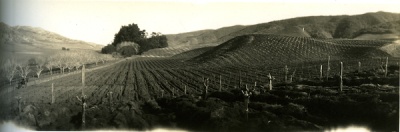
Rough plowed vineyard east of cellar, road to the east, and eucalyptus trees at the Selva.
Santa Cruz Island, Symmes, 1922
Burgundy vineyard on lower slopes with typical growth of brush and cactus on hills in the rear. Dry wash of Main creek in foreground.
Santa Cruz Island, Symmes, 1922
Part of Church District vineyard, hay in Campo Dos Pinos, winery at left, church at right, ranch in middle background with chaparral covered secondary ridge in back.
Santa Cruz Island, Symmes, 1922
Fields west of ranch, Upper at right,
Domestic at left and part of General in foreground.
Santa Cruz Island, Symmes, 1922
The European field.
Santa Cruz Island, Symmes, 1922
Main creek at Cascada showing flow of water sufficient to supply Main Ranch and irrigate considerable land in addition.
Santa Cruz Island, Symmes, 1922
Main creek just below ranch showing surface flow sufficient to irrigate all level land in Main Valley.
Santa Cruz Island, Symmes, 1922
Area of Monterey pine in upper reaches of Cañada la Cuesta.
Largest area and best stand found on the island.
Santa Cruz Island, Symmes, 1922
North shore of Island above Pelican Bay showing area of
Monterey pine known as Pinos Chicos.
Barren area at right due to fire in 1918.
Santa Cruz Island, Symmes, 1922
Sur side range east of Sur Ranch, badly cut up by barrancas and canyons showing typical limestone formation.
Santa Cruz Island, Symmes, 1922
Prisoners Harbor showing wharf, mouth of creek, beach, brick warehouses, adobe house, lagunita, small cultivated field and eucalyptus trees. Growth on hills to the right very typical of large area of north coast from Prisoners west.
Santa Cruz Island, Symmes, 1922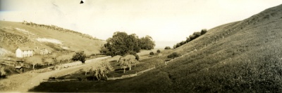
Smugglers Cove with heavy growth of feed on lime adobe hillsides where sheep have not fed to any extent. Adobe house, fig, walnut, eucalyptus and olive trees shown. Cuts in the hillside show limestone formation plainly.
Santa Cruz Island, Symmes, 1922- MISSING
Pelican Bay with cottages on spit running out to form the bay, Diablo ridge in the distance, growth on hills principally Monterey pine, oak and manzanita.
Santa Cruz Island, Symmes, 1922 
Potato Harbor showing seal cave and cliffs.
Santa Cruz Island, Symmes, 1922
Flats east of Forneys showing caves in volcanic rock,
formerly inhabited by Indians.
Santa Cruz Island, Symmes, 1922
East entrance and beach Cueva Valdez.
North entrance shown as line on face of cliff at right.
Santa Cruz Island, Symmes, 1922
View through North entrance Cueva Valdez looking
across harbor showing cliffs and rock formation.
Santa Cruz Island, Symmes, 1922


