File:SCRI Historic Base Map.jpg
From Islapedia
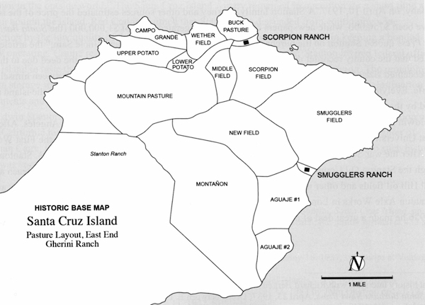
No higher resolution available.
SCRI_Historic_Base_Map.jpg (600 × 431 pixels, file size: 101 KB, MIME type: image/jpeg)
File history
Click on a date/time to view the file as it appeared at that time.
| Date/Time | Thumbnail | Dimensions | User | Comment | |
|---|---|---|---|---|---|
| current | 13:35, 20 March 2017 | | 600 × 431 (101 KB) | MDaily (talk | contribs) |
You cannot overwrite this file.
File usage
The following 12 pages use this file:
- Aguaje, Santa Cruz Island
- Buck Pasture, Santa Cruz Island
- Campo Grande, Santa Cruz Island
- Middle Field, Santa Cruz Island
- Montañon, Santa Cruz Island
- Mountain Pasture, Santa Cruz Island
- New Field, Santa Cruz Island
- Potato Harbor, Santa Cruz Island
- Scorpion Field, Santa Cruz Island
- Scorpion Ranch, Santa Cruz Island
- Smugglers Field, Santa Cruz Island
- Smugglers Ranch, Santa Cruz Island


